


Yosemite National Park
Interpretive Media
Yosemite National Park receives over 4 million visitors per year, including national and international tourists and campers. Working with NPS staff, Chad Upham led the design and development of the first official NPS Yosemite App and interpretive signs, making important visitor information easy to access and understand.
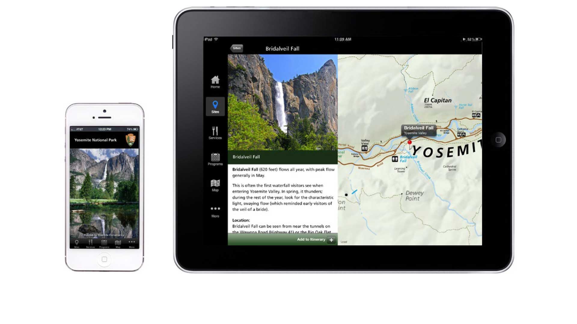
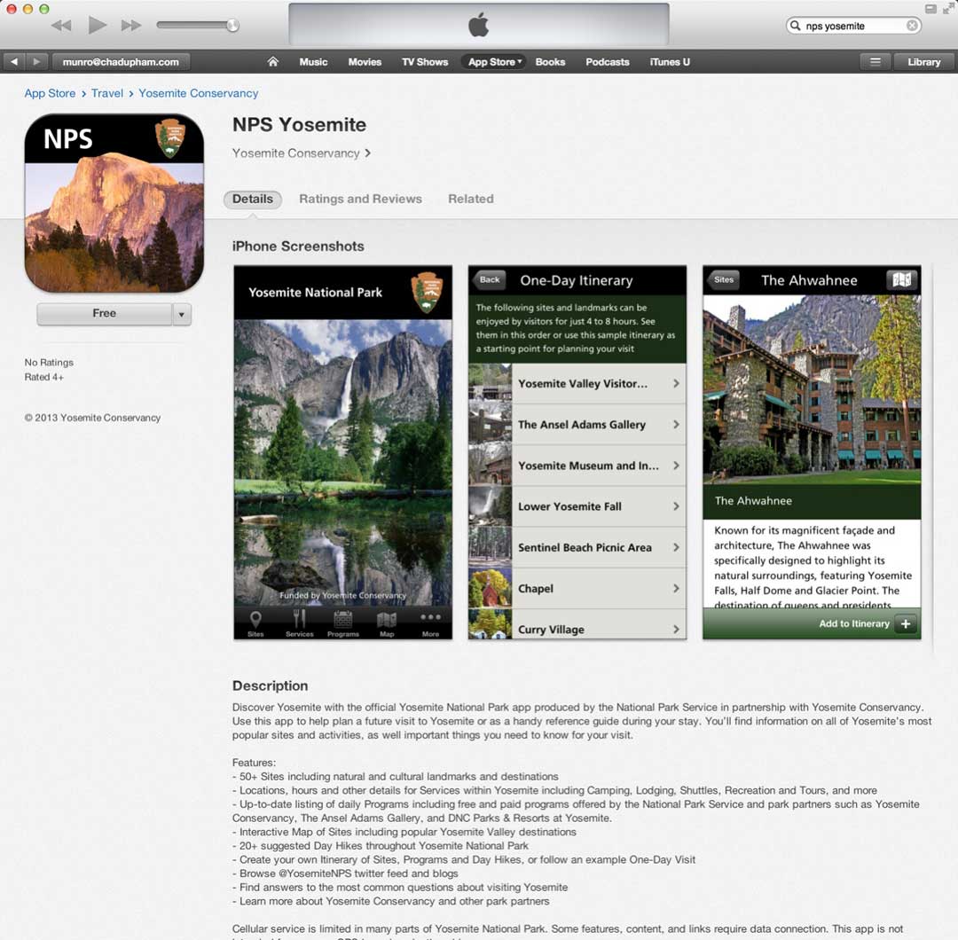
NPS Yosemite App
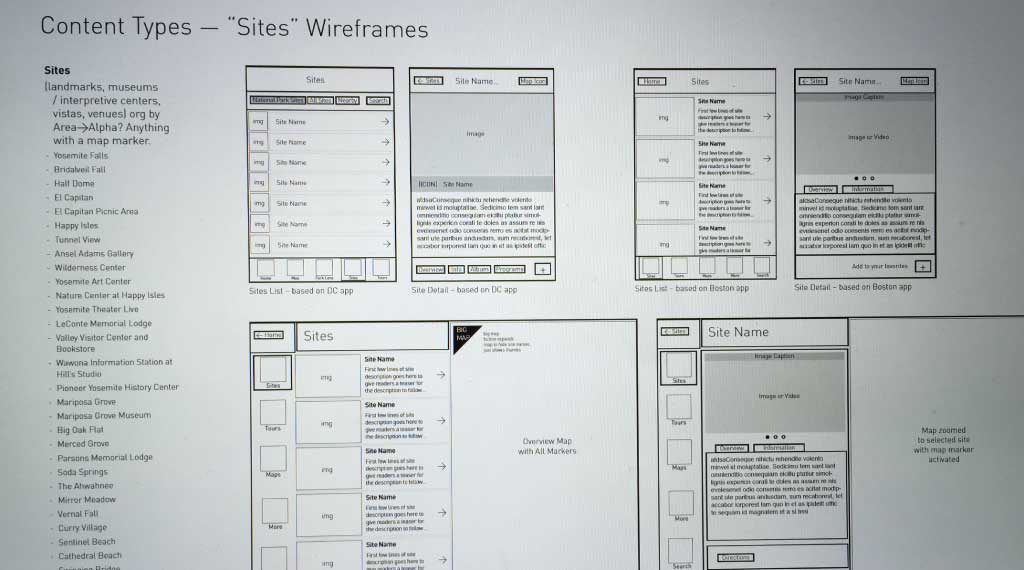
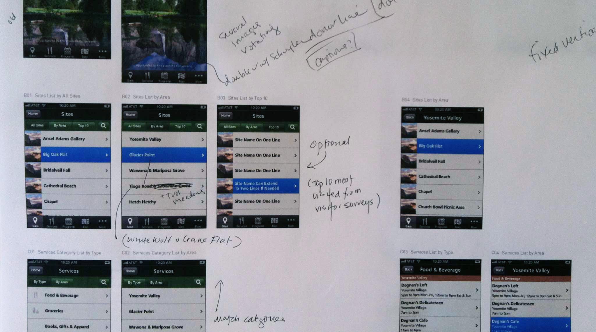
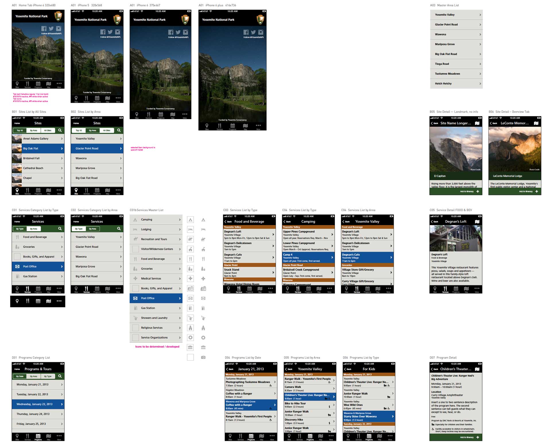
In 2013, Chad Upham guided the design process of the first official NPS Yosemite App for iOS iPhones/iPad and Android, from concept through launch in a period of 10 months. The app organizes content into: sites, services, programs, map, and more, with several special features including an “Add to my itinerary” function and an NPS themed photo frame for selfies.
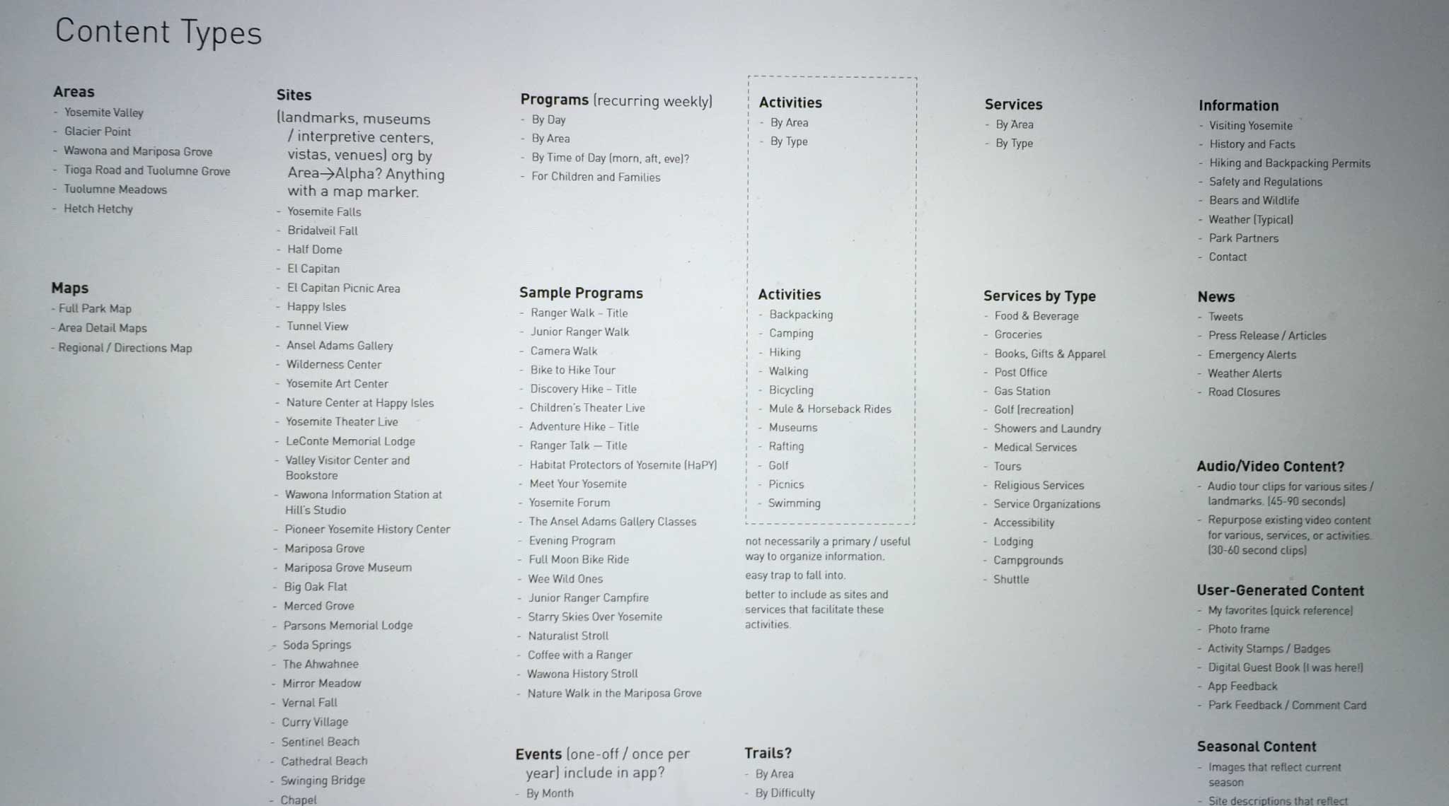
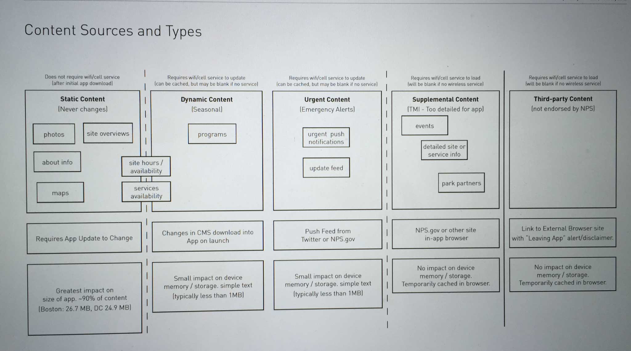
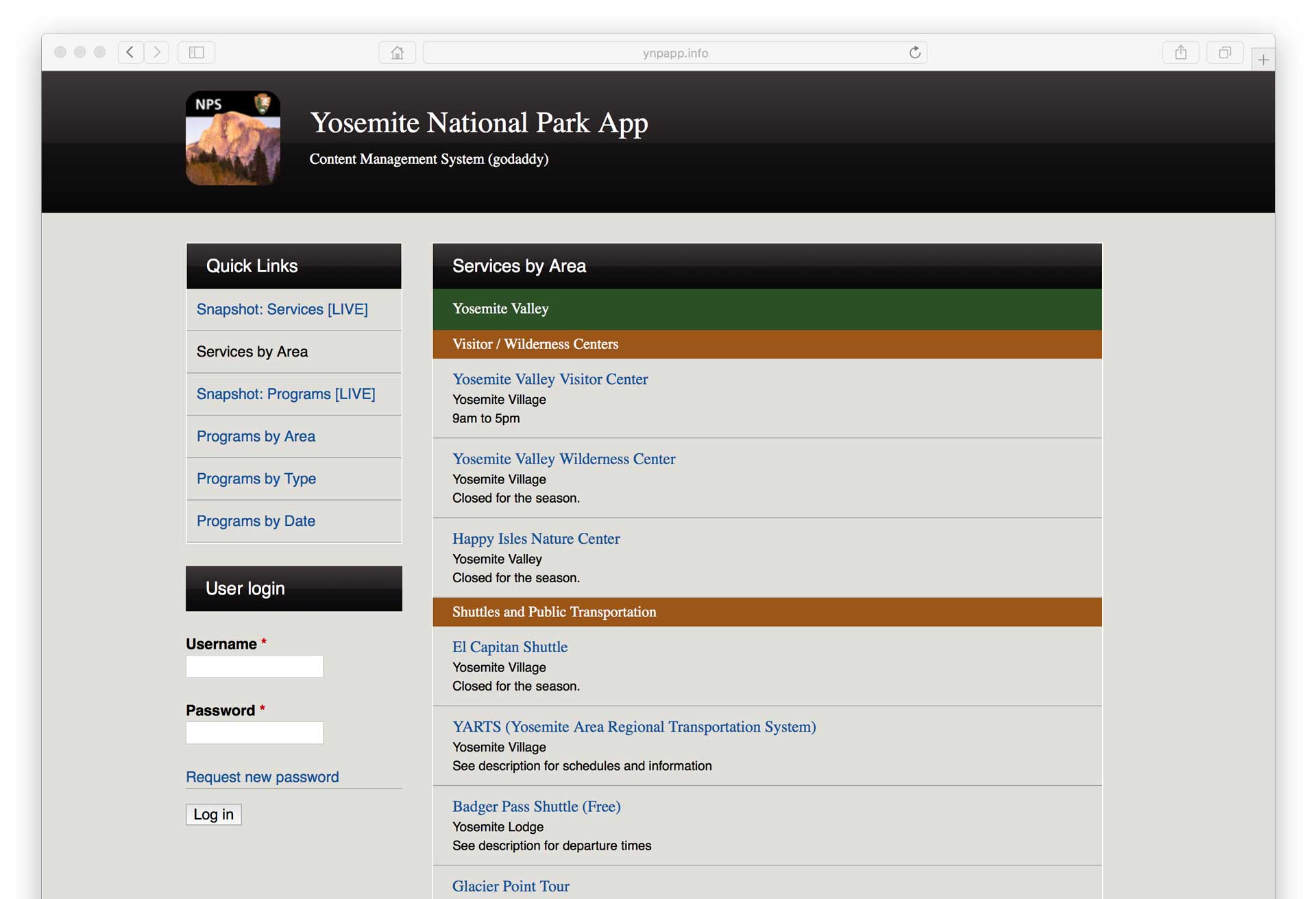
App Content Management System
A content management system was built allowing NPS staff to update dynamic content pushed to the app to correspond with seasonal changes. Once updated content was pulled into the app, it was self-contained to function without cell phone signal in the many remote areas of the park.
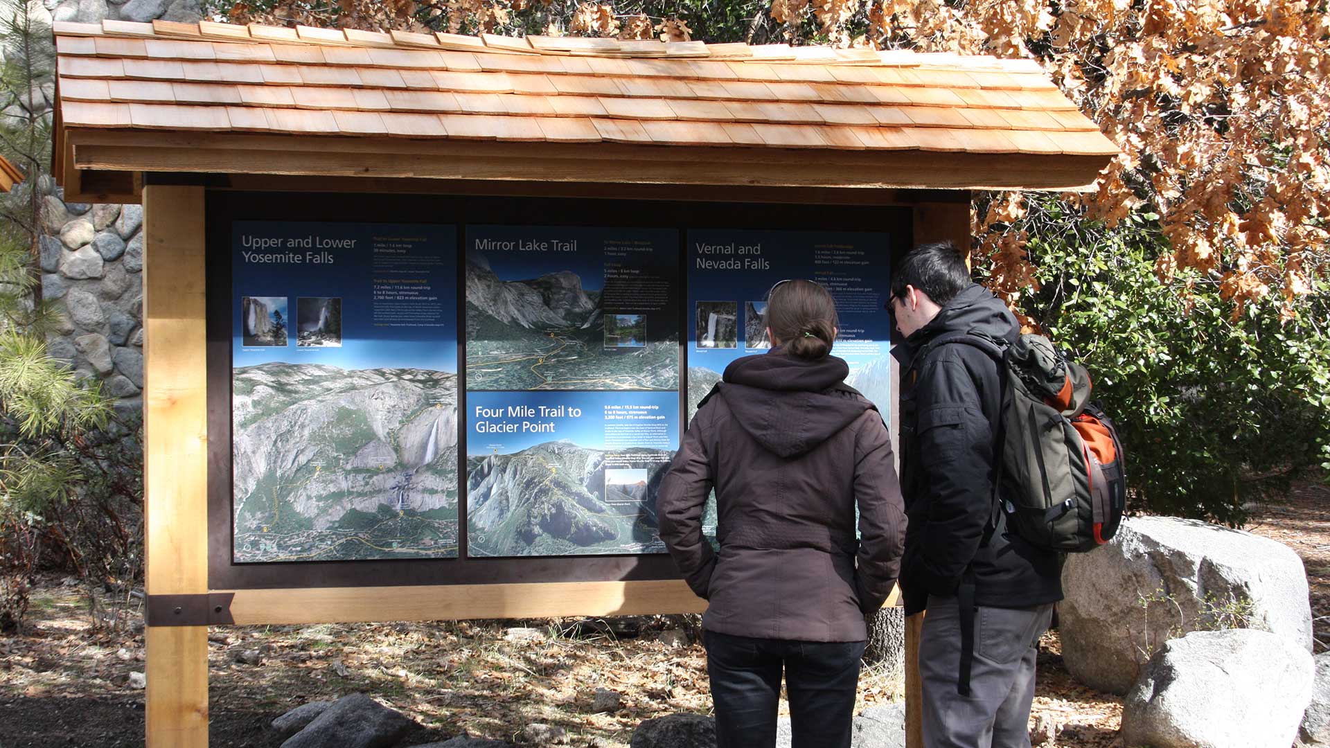
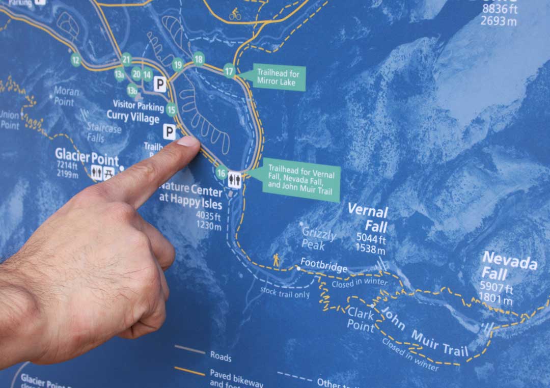
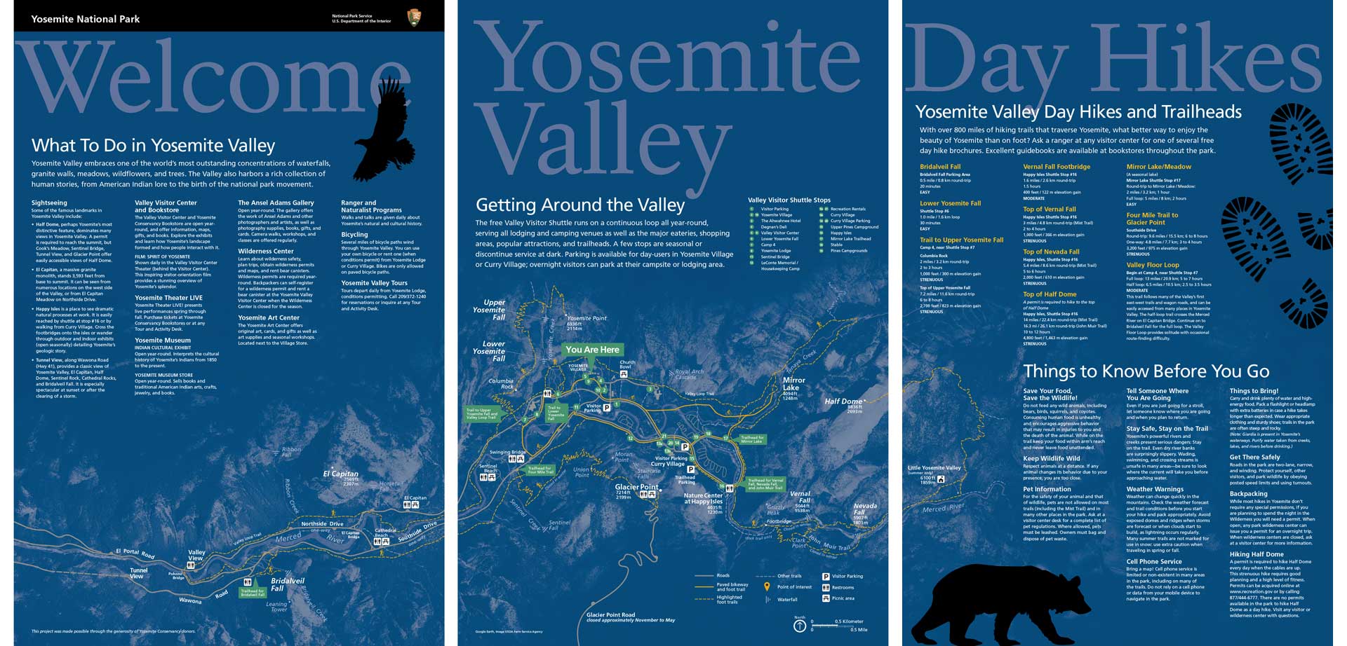
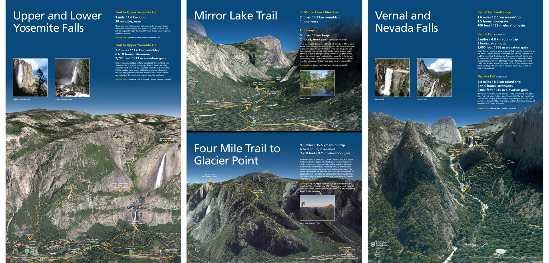
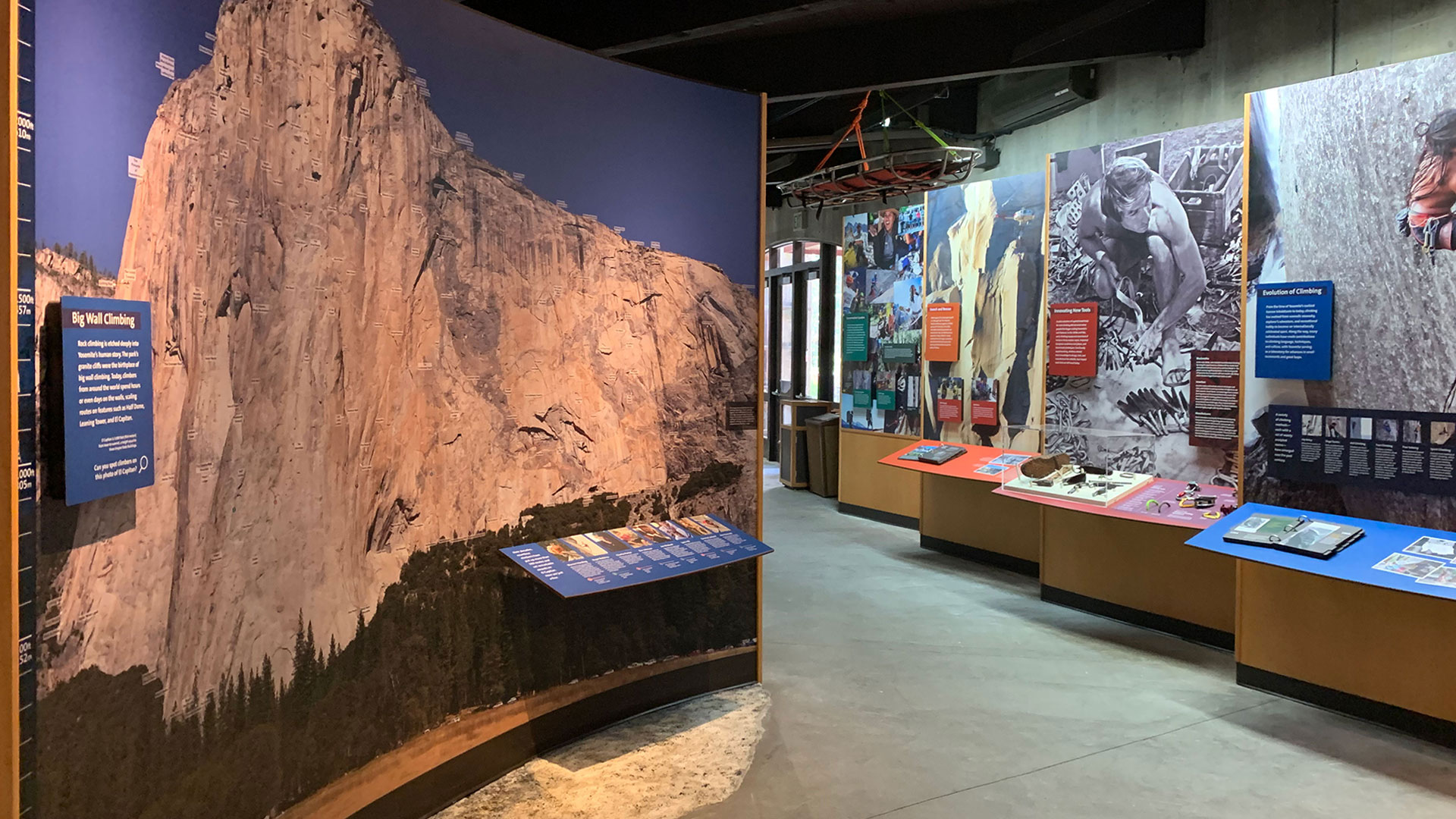
Interpretive Signs and Trail Information
In peak seasons, there can be long lines to speak with a ranger at the Yosemite Valley Visitor Center for visitors seeking basic information and recommendations for hiking and other recreational activities. Working with NPS staff, a series of outdoor sign panels was designed to provide answers to common questions, and demonstrate the distance and difficulty of some of Yosemite Valley’s most popular day hikes. Using Google Earth to render three dimensional elevations and trails, the maps help visitors plan their trips for maximum safety and enjoyment.